8 Essential Tips for the Madeira Crossing Hike
Plan your Madeira crossing hike with our 2025 guide. Includes MIUT route stages, new permit fees, camping at Pico Ruivo, and essential gear tips.
On this page
8 Essential Tips for the 5-Day Madeira Crossing Hike
The Madeira crossing hike is a coast-to-coast traverse of one of the Atlantic's most dramatic islands — 115 kilometres from Porto Moniz in the northwest to Machico in the southeast, with around 7,000 to 8,000 metres of total elevation gain. It is not a single waymarked trail but a route that most thru-hikers piece together along the Madeira Island Ultra Trail (MIUT) race corridor. Completing it in 4 to 6 days is achievable for fit hikers who plan logistics carefully.
Before you head out, read through our overview of how to Visit Madeira: 23 Best Things to Do and Travel Tips to handle flights, transport, and accommodation on the island. The guide below covers every planning stage: which route to pick, the 2026 permit system, water sources, camping, gear, and two on-the-ground safety details that most articles skip entirely.
Understanding the Madeira Island Crossing
Madeira is a Portuguese autonomous region roughly 22 km wide and 57 km long, rising to 1,862 m at Pico Ruivo. Despite its compact size, the terrain is extreme: near-vertical ridges, ancient stone staircases, and laurel forest paths carved along levadas (historic irrigation channels cut into cliffsides). The crossing covers this full range of landscapes in one continuous push.
The standard route runs west to east, starting in Porto Moniz and finishing in Machico. Total hiking time for an average fit person is 4 to 5 days at a comfortable trekking pace, or 3.5 days moving fast with a light pack. The MIUT ultra-trail covers the same corridor in 15 to 30 hours for elite runners, completing 7,000-plus metres of gain in a single effort.
The 2024 wildfires burned significant sections of the central highlands around Encumeada and the Pico Arieiro massif. As of early 2026, some PR-classified sections remain closed or rerouted. Always check the IFCN "Recommended Routes" page at Ifcn.madeira.gov.pt before setting out each day. The site lists current closures in Portuguese and is updated regularly after weather events.
MIUT vs. Caminho Real 23: Which Route to Choose?
Most thru-hikers face a choice between two main corridors. The MIUT (Madeira Island Ultra Trail) route is high, exposed, and technical. The Caminho Real 23 is a historical royal path that stays lower and passes through more inhabited valleys. Here is how they compare for a typical trekker:
- MIUT route: 115 km, 7,000–8,000 m elevation gain, 4–5 days trekking pace. Stays on the central ridge with dramatic views. Few villages or supply points. Requires camping or the Pico Ruivo mountain hut. Best for fit hikers with camping experience.
- Caminho Real 23: approximately 150–180 km, 6–8 days, lower elevation profile. Passes through traditional villages with cafes and guesthouses. Better resupply options and more shelter. Suited to hikers who prefer beds and hot meals over peak-bagging.
- Hybrid: Many hikers combine the MIUT ridge sections (Pico Arieiro to Pico Ruivo) with lower Caminho Real legs. This gives the best scenery without committing to full ridge camping.
The MIUT corridor is the better choice if your goal is the full island crossing in minimum time with maximum altitude. The Caminho Real suits those who want to experience Madeiran village culture alongside the mountains. If this is your first time on the island, the MIUT gives you the iconic views most photos of Madeira show.
You can find more on the island's individual trails in our Madeira activities guide, which covers day hikes and levada walks suitable for non-thru-hikers in your group.
Navigating the 2026 Permit and Fee System
Since 2025, Madeira charges a Classified Pedestrian Route Fee of 3 Euro per person for each designated PR trail. This is not a single multi-day pass — each classified route segment requires its own payment. The PR1 (Pico do Arieiro to Pico Ruivo) and PR6 are the most commonly checked by rangers in 2026.
To pay, visit the IFCN portal at Ifcn.madeira.gov.pt, navigate to "Percursos Pedestres" (Pedestrian Routes), select the trail, choose your date, and pay by card. You receive a digital receipt with a QR code. Rangers scan this on trail. Save the PDF offline before entering areas with no mobile signal. Children under 12 hike free on most routes.
Wild camping requires a separate, free license from the IFCN. You select specific forest zones and dates when applying. This permit must be requested at least 7 days before your trip and cannot be obtained on the day. The Pico Ruivo mountain hut (Casa de Abrigo do Pico Ruivo) is separate — it charges a nightly fee and must be booked directly with the IFCN by phone or via the portal, ideally 30 to 60 days in advance during spring and autumn.
Save your IFCN permit QR code as a PDF before setting off — rangers scan it on trail and mobile signal on the high ridges is unreliable. Children under 12 hike free on most classified routes.
Optimal Seasons for High-Altitude Hiking
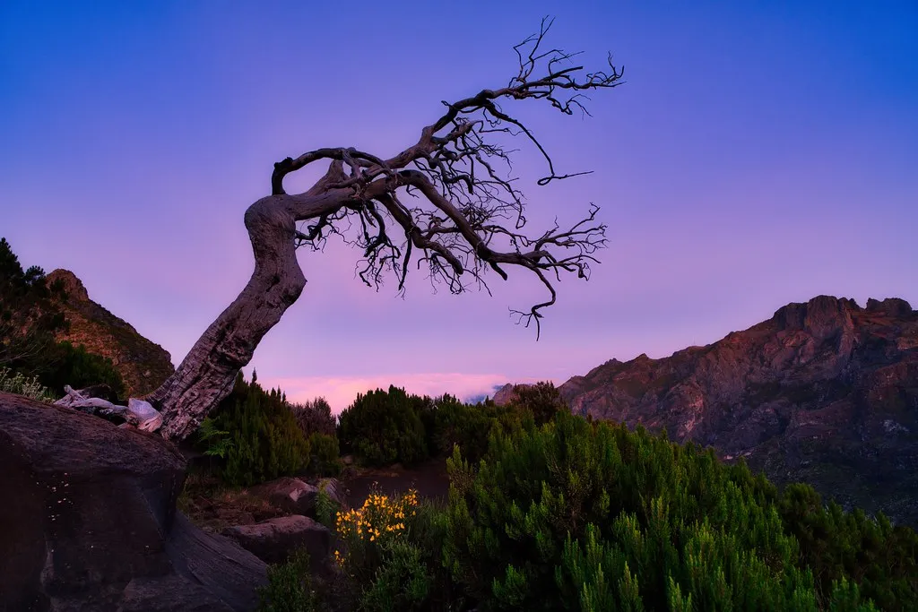
Madeira's climate is subtropical year-round, but the high-altitude sections above 1,500 m behave differently from the coast. The island receives most of its rain between October and February. The summits of Pico Ruivo and Pico Arieiro can sit in cloud for days at a time in winter, dropping temperatures to near-freezing with strong winds.
April and May are widely considered the best months for the crossing. The island is in full bloom, wildfire risk is low, and the peaks are most likely to offer clear skies. Rain is possible but typically brief. June to September is warmer and drier but the high ridges become crowded, especially on the PR1 between Arieiro and Ruivo. Starting by 06:00 on busy summer days is worth the early alarm.
November is viable — one competitor in this SERP hiked it solo in November and found all cafes and accommodation open — but expect misty, cold summits and muddy trails. Avoid July and August for the central camp zones if you value solitude; both the Pico Ruivo hut and designated camping areas book out weeks in advance.
Water Management and Resupply Logistics
Water availability is uneven along the crossing and deserves its own planning session. On levada sections in the forest valleys, water is generally plentiful from channels and streams — but levada water must be treated or filtered before drinking. Carry a filter (Sawyer Squeeze or similar) rather than relying on tablets alone, as silt levels in forest channels are high.
On the exposed high ridges between Paul da Serra and Pico Ruivo, reliable natural water disappears almost entirely. This section can take 6 to 9 hours depending on pace. Carry a minimum of 2.5 litres when leaving any valley before the ridge. Collapsible water bottles work well here because they pack flat when empty and expand when you fill up at the last stream.
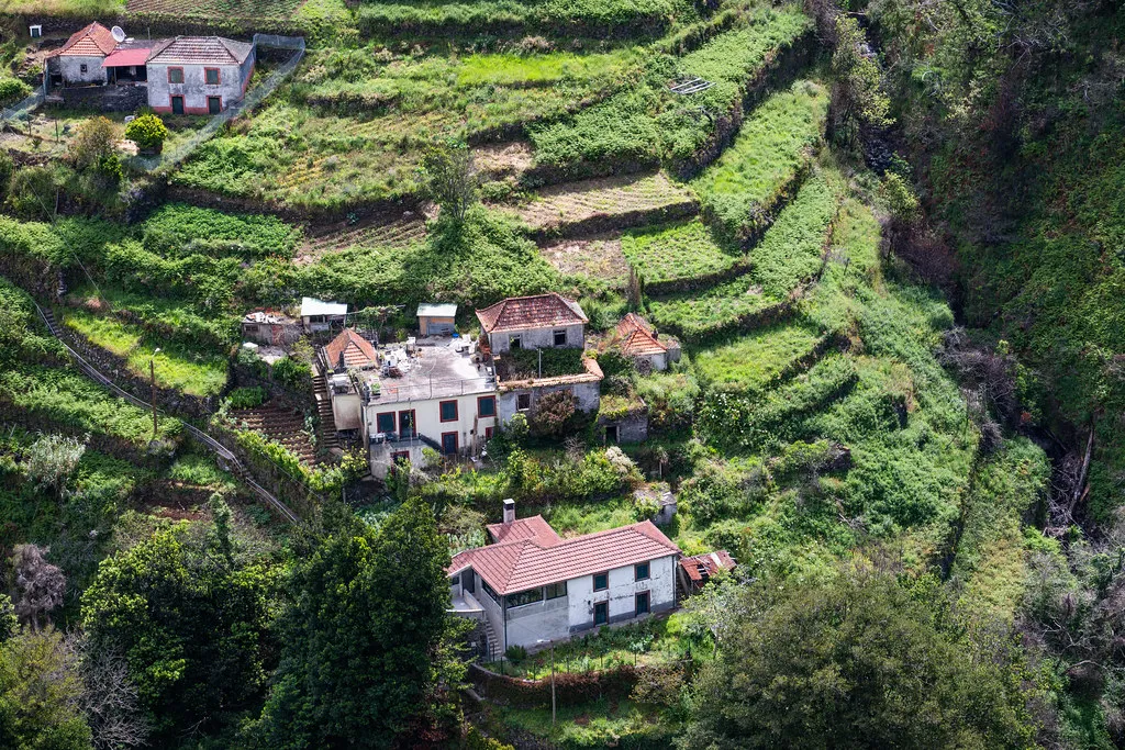
Resupply towns along the route are limited. Porto Moniz has a supermarket for your start-day load. Encumeada has a bar-cafe at the pass. Ribeiro Frio has a small restaurant open in season. Machico at the finish has full supermarket options. Funchal, a 30-minute drive or bus from most stages, is the best place to buy camping gas, dehydrated food, and any gear you forgot. A Decathlon is located near the marina.
Camping at Pico Ruivo and Trail Stays
The overnight stop below Pico Ruivo is the emotional centerpiece of the crossing. At 1,800 m, the small designated camp area sits above the cloud inversion that often fills the valleys below. Sunset and sunrise here are genuinely spectacular. Bring a warm sleeping bag rated to at least -5°C because the wind drops the effective temperature significantly even in May.
The Casa de Abrigo do Pico Ruivo mountain hut offers dormitory-style beds and a basic kitchen. It is the only fully covered shelter on the MIUT corridor. Booking at least one month in advance is realistic for spring and autumn weekends. If the hut is full, the designated camping zone immediately below it is the licensed alternative — book this via the IFCN camping permit system.
Other overnight options on the route: the Paul da Serra plateau has a designated camping area near the wind turbines (exposed, cold, but a logical end to Day 1 from Porto Moniz). Ribeiro Frio has guesthouses in the village. For nights without a designated site, the island has a relaxed enforcement attitude to discreet wild camping — arrive late, leave early, leave no trace, and do not light fires. Fire is the single biggest hazard on the island; the 2024 wildfires that closed central trails began as uncontrolled camping fires.
Never light a fire in wild camping zones. The 2024 wildfires that closed central trail sections of the Madeira crossing were started by uncontrolled camping fires. Use a gas stove only, and check the IFCN closure page before each day's stage.
The 5-Day Coast-to-Coast Itinerary
The following stages follow the MIUT corridor at a trekking pace. The total distance is approximately 115 km with 7,000 to 8,000 m of elevation gain. Download a GPX file from the Thru-Hiking Madeira route page before you leave — mobile signal on the high ridges is unreliable.
- Day 1: Porto Moniz to Paul da Serra — Approx. 30 km, 2,300 m gain. Start at the lava pools in the town center at 07:00. Three major climbs: out of Porto Moniz, up through Fanal forest (ancient Laurisilva trees, often foggy), and the final 1,300 m grind to the Paul da Serra plateau. Camp near the wind turbines. Expect 9 to 10 hours moving time.
- Day 2: Paul da Serra to Nun's Valley (Curral das Freiras) — Approx. 25 km, 1,800 m gain. Long descent through the Folhadal forest and the scenic "Amazonias" Laurisilva section. Reach Encumeada pass for a mid-day break at the bar. Climb to Relvinha and descend into the valley. Camp by the river or stay at a local guesthouse.
- Day 3: Nun's Valley to Pico Ruivo — Approx. 22 km, 2,400 m gain. The hardest day. A 1,400 m climb to Pico Ruivo, the island's highest point at 1,862 m. Continue along the ridge to Pico Arieiro (1,818 m) on the PR1. Sleep at the hut or designated camp below Ruivo. Start by 08:00 to avoid day-tripper crowds on the PR1 section.
- Day 4: Pico Ruivo to Ribeiro Frio — Approx. 18 km, 1,000 m gain. Mostly downhill through eucalyptus forest and levada trails. Levada do Furado is a highlight. Trail is often muddy and slippery. Village guesthouse stay at Ribeiro Frio recommended.
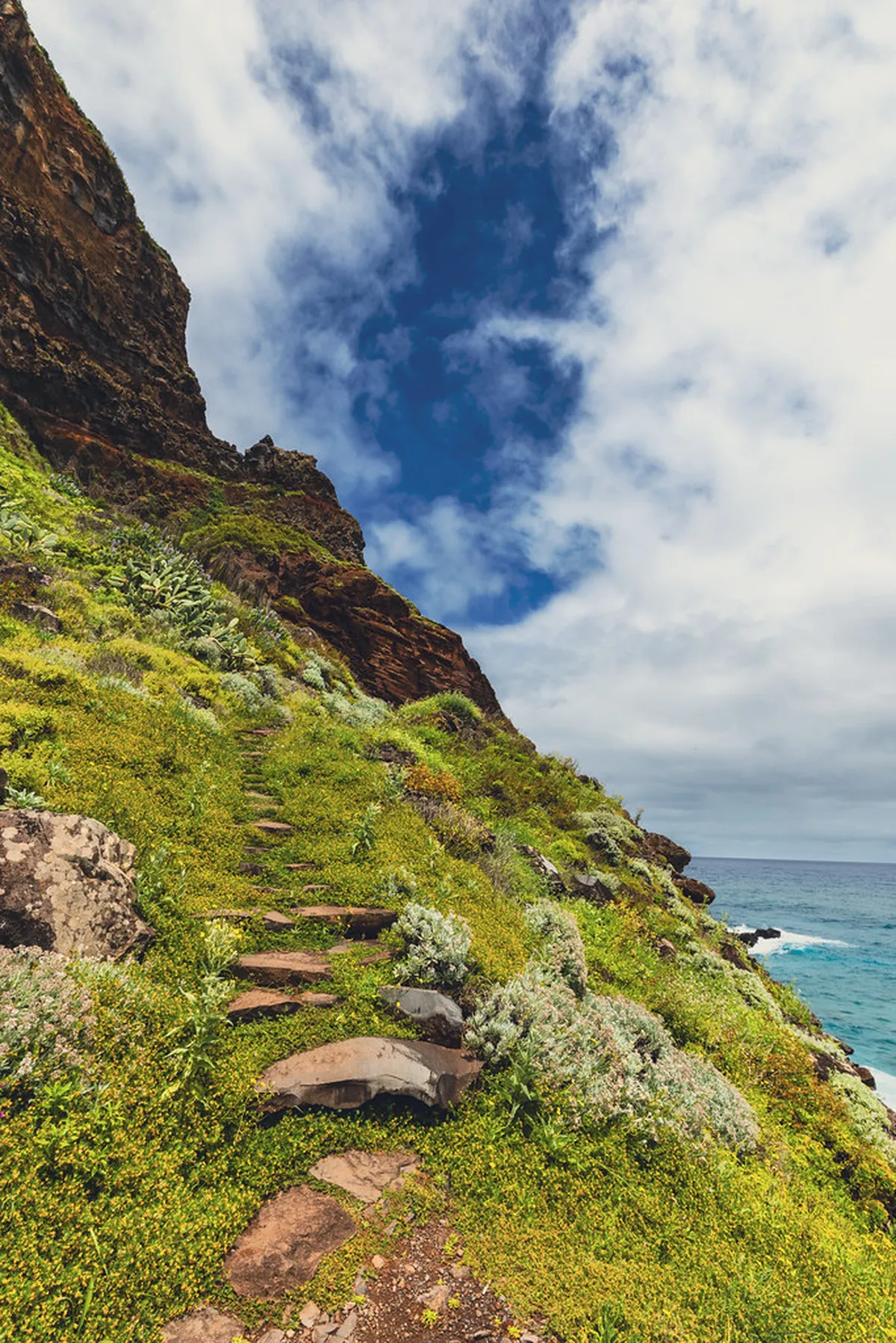
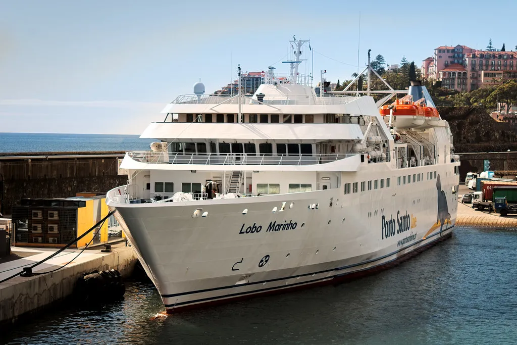
- Day 5: Ribeiro Frio to Machico — Approx. 22 km, 700 m gain. Descend through the eastern forest to Vereda do Larano on the coast. The final coastal clifftop section above Machico is one of the most scenic stretches of the whole route. Finish at the pier in Machico by early afternoon.
Getting to the start: the most reliable option is a Bolt taxi from Funchal to Porto Moniz, costing 40 to 60 Euro. There is also a public bus from Funchal (Rodoeste line 80) but it runs infrequently. From Machico at the finish, bus 113 connects back to Funchal in under 30 minutes, and the airport is a 10-minute drive away.
Two Navigation Hazards Worth Knowing Before You Go
The first hazard is the PR17 levada tunnels on the eastern section of the route. These tunnels are long — some stretch for hundreds of metres — and so narrow that two people cannot pass each other easily. The vast majority of day-hikers walk this section east to west. If you are doing the crossing west to east (the standard thru-hike direction), you will be walking against traffic. The practical fix: walk the PR17 tunnel section before 07:30 or after 16:30 to avoid the day-tripper rush entirely. A head torch is mandatory regardless of the time.
The second hazard is specific to the eastern half of the island near Machico and Canical. Downhill mountain biking is popular in this area and the bike trails are poorly signed. It is genuinely easy to mistake a fast-descent bike track for a hiking path. If you find yourself on a wide, cleared dirt run with a steep gradient and berms, you are on a bike trail. Backtrack and look for the PR waymarkers (wooden posts with colored bands). Moving quickly on the final descent into Machico, the distinction matters.
A third point worth flagging: the 2024 wildfires are ongoing in their impact on 2026 route planning. Before your trip, open the IFCN recommended routes page and cross-reference each day's intended path against the current closure list. Several sections near the Encumeada area were still marked as requiring a detour as of early 2026. Reroutes add distance and elevation, so factor in a 10% buffer on your daily stage estimates if closures are in effect.
Critical Gear for Madeira's Microclimates
Madeira's weather is famously unpredictable. The north and south coasts can be in different weather systems at the same time, and the high peaks generate their own cloud cover regardless of the forecast. A waterproof hardshell jacket rated at least 20,000 mm hydrostatic head is the single most important piece of kit. You will likely wear it every day.
Layering handles the temperature swing from 10°C on the summits to 28°C on the coastal approach. Moisture-wicking base layers are essential — cotton kills on the long climbs. Add a mid-layer fleece for the high camps. Gloves and a beanie are worth carrying from October through May.
The following items are commonly forgotten but consistently flagged by thru-hikers:
- Head torch with spare batteries — mandatory for levada tunnels; some are 300 m long with no light.
- Water filter — Sawyer Squeeze or similar; levada water is abundant but untreated.
- Gaiters — forest trails above Ribeiro Frio are consistently muddy from October to June.
- Trekking poles — the stone staircase descents (especially out of Nun's Valley) are knee-destroying without poles.
- A trowel — required for waste burial in wild camping zones; enforce Leave No Trace strictly.
- Power bank (10,000 mAh minimum) — charging opportunities are limited to cafes at Encumeada and Ribeiro Frio.
Trail running shoes with aggressive grip work well if you are moving fast and light. For a loaded 5-day pack, mid-cut hiking boots with ankle support are safer on the wet stone stairs. Check this Hikingfex route description for an additional gear breakdown from a recent crossing.
Frequently Asked Questions
Do you need a guide for the Madeira Island Ultra Trail?
You do not need a guide if you are an experienced hiker. The trails are well-marked with PR signs and GPS tracks are available. However, a guide can help with logistics and local history.
How much are the Madeira hiking fees in 2025?
The fee is 3 Euros per person for each classified pedestrian route. You must pay this online through the official IFCN portal. Children under 12 years old can usually hike for free.
Can you wild camp on the Madeira crossing?
Wild camping is only allowed in designated areas with a free permit. You must request this license from the IFCN website in advance. Always follow Leave No Trace principles to protect the forest.
The Madeira crossing hike rewards preparation above all else. Sort your IFCN permits before you fly, check the current wildfire closure list, and carry more water than you think you need on the high ridge sections. Everything else — the Laurisilva fog, the sunrise from Pico Ruivo, the final descent into Machico — will take care of itself.
For more on the island, visit our Portugal Wander blog for updated guides on accommodation, day hikes, and the best levada walks for those who prefer something shorter than a 5-day thru-hike.
See our Madeira attractions guide for the broader island overview.
For related Madeira deep-dives, see our 22 Best Madeira Attractions and 22 Best Madeira Activities for Your 2026 Island Adventure guides.